The race to digitally preserve our heritage isn’t about choosing a scanner; it’s about executing a high-stakes logistical and ethical mission where the wrong technical choice can mean digital oblivion.
- Photogrammetry can outperform LiDAR for textural fidelity, but success depends entirely on mission planning and lighting control.
- The “Terabyte Problem” of massive data files is a primary bottleneck, solvable only through rigorous data management and intelligent compression.
Recommendation: Prioritize a format-agnostic, long-term Data Management Plan (DMP) *before* the first scan is ever taken.
For archaeologists and historians on the front lines, the mission to preserve cultural heritage is a race against time. Faced with the irreversible threats of conflict, climate change, and decay, digital archiving offers a promise of immortality. The common discourse often simplifies this monumental task into a technological showdown: LiDAR for its rigid accuracy versus photogrammetry for its visual richness. This conversation, while necessary, dangerously overlooks the real challenges that occur after the scanner is packed away.
The true battle for our digital legacy isn’t fought over millimeters of accuracy alone. It’s a complex war waged on multiple fronts: the logistical nightmare of managing terabytes of raw data, the technical minefield of file format obsolescence, and the profound ethical dilemmas of reconstruction. Focusing solely on the capture method is like planning a complex expedition by only choosing the type of camera, without considering the route, supplies, or the ultimate purpose of the journey.
This guide reframes the discussion. We will move beyond the platitudes to address the critical strategic trade-offs that practitioners face in the field. Instead of asking *which* technology is best, we will explore *when* and *why* a specific approach is the right one. We will tackle the data logistics that can cripple a project, the file format errors that can erase history, and the ethical frameworks that must guide our hand. This is not about choosing a tool; it’s about developing a resilient strategy for digital survival.
This article provides a technical and strategic overview of the critical decisions involved in digital heritage preservation. We will navigate from the nuances of data capture to the long-term challenges of storage and ethics, offering a complete picture for professionals in the field.
Summary: Digital Heritage Preservation: A Strategic Guide
- Why Taking 1,000 Photos Creates a Better 3D Model Than Lidar?
- How to Optimize Point Clouds for Real-Time Rendering?
- Lidar or Camera: Which Is Best for Scanning Dark Interiors?
- The Terabyte Problem That Slows Down Digital Archaeology
- How to Plan a Scanning Mission to Avoid Lighting Changes?
- The File Format Error That Could Erase Digital Art History
- Rebuild or Project: Which Preservation Method Is More Ethical?
- Reconstructing Ancient Monuments: Boosting Tourism in Heritage Sites?
Why Taking 1,000 Photos Creates a Better 3D Model Than Lidar?
The prevailing wisdom pits LiDAR as the champion of geometric accuracy and photogrammetry as the master of visual texture. While LiDAR’s active laser measurement provides undeniable precision, the assumption that it always yields a “better” model is a critical oversimplification. For cultural heritage, where an object’s story is told as much through its painted surfaces and subtle weathering as its shape, photogrammetry often holds a distinct advantage. The sheer density and quality of photographic data can produce models with unparalleled textural fidelity.
By capturing hundreds or thousands of high-resolution images from myriad angles, photogrammetry software reconstructs not just the form but the authentic color and material properties of a surface. This process, known as Structure from Motion (SfM), can achieve astonishing precision. In fact, comprehensive field testing shows that drone-based photogrammetry can deliver 1 cm horizontal accuracy with 2-4 cm vertical accuracy, rivaling LiDAR in many applications. For a faded fresco or an inscribed stone, this level of color and surface detail is not a cosmetic enhancement; it is the primary data.
The choice is therefore not about abstract “betterness,” but about the objective. If the goal is to measure the structural deformation of a cathedral wall, LiDAR’s direct measurement is superior. But if the goal is to document the delicate brushstrokes of a manuscript or the patina on a bronze statue for future study, the thousands of pixels captured by a camera offer a richer, more scientifically valuable dataset. The strategic trade-off is between raw geometric certainty and a complete, photorealistic archival record.
How to Optimize Point Clouds for Real-Time Rendering?
Capturing a site is only the first step. The result—a point cloud containing billions of individual points—is often a multi-terabyte file that is unworkable for real-time analysis, web-based viewing, or virtual reality experiences. The challenge of optimization is to drastically reduce this data load without sacrificing the very details we sought to preserve. This is a critical bottleneck in the data logistics of digital archaeology, and brute-force simplification is not an option, as it can destroy culturally significant features.
The solution lies in intelligent, perception-based optimization. Rather than uniformly down-sampling the entire model, advanced algorithms can identify and prioritize areas of high geometric and textural complexity. This involves creating a Level of Detail (LOD) system where geometrically simple areas, like a flat wall, are represented with far fewer points than a complex area, like a carved capital. Modern game engines have pioneered this approach for heritage visualization.

A prime example is the development of AI-driven quality metrics. As highlighted in research on Unreal Engine’s Nanite technology, these systems can be trained on large datasets to understand what constitutes a visually or culturally important feature. This allows for what is known as AI-driven perceptual optimization, which preserves areas of high cultural importance (like inscriptions or carvings) while aggressively simplifying geometrically simple surfaces. This results in a model that is visually almost identical to the original but is a fraction of the size, making it usable for researchers and the public alike.
Lidar or Camera: Which Is Best for Scanning Dark Interiors?
Scanning the unlit interiors of tombs, crypts, or subterranean chambers presents one of the most extreme challenges in digital preservation. Here, the strategic trade-off between LiDAR and photogrammetry becomes a high-stakes decision. Conventional wisdom suggests LiDAR, as an active scanning technology, is the obvious choice. It generates its own light via laser pulses and is largely immune to the ambient darkness that cripples a standard camera sensor.
The data supports this initial assessment. LiDAR’s ability to function in poor visibility is one of its core strengths. A recent analysis confirms that LiDAR maintains 1-3 cm vertical accuracy even in low-light conditions, where photogrammetry would typically fail due to noise and lack of discernible features. For capturing the raw geometry of a dark space quickly and reliably, LiDAR is an incredibly powerful tool. However, this geometric map often lacks the color and texture information that gives the site its historical context.
This is where expert-led photogrammetry can defy expectations. It is not about using a camera in the dark; it is about controlling the light. The team at Factum Arte provides a compelling case study. By employing techniques like High Dynamic Range (HDR) bracketing and “light painting” (methodically illuminating parts of the scene across multiple exposures), they successfully captured dark crypts with stunning detail. Their approach demonstrates that a meticulously planned photogrammetry mission can yield a model that is both scientifically and aesthetically richer than an automated LiDAR scan. The choice is not just between two technologies, but between an automated process and a handcrafted, expert-driven one.
The Terabyte Problem That Slows Down Digital Archaeology
The success of a 3D scanning mission can paradoxically become its greatest failure. The creation of a hyper-detailed, millimeter-accurate digital twin results in colossal datasets, often spanning multiple terabytes. This “Terabyte Problem” creates a massive logistical bottleneck, hindering analysis, collaboration, and long-term storage. An unmanaged data explosion can render a project’s output effectively useless, locking away priceless information on inaccessible hard drives. The solution is not to capture less data, but to manage it with ruthless efficiency from the outset.
The first line of defense is intelligent compression. This is not simply about reducing file size; it’s about doing so without losing vital information. For this, lossless compression is often insufficient. Advanced lossy compression algorithms, guided by perceptual metrics, are essential. Groundbreaking research published in the journal *Electronics* shows that intelligent lossy compression can achieve a 95% reduction in file size with visually imperceptible loss. This is achieved by strategically discarding redundant data while preserving the geometric and textural detail that defines the object.
However, technology alone is not enough. A robust Data Management Plan (DMP) is the strategic framework required to prevent data chaos. It is a document that must be created *before* the first scan is taken, outlining every step of the data’s lifecycle. Without a DMP, even the most beautifully captured data is at risk of becoming a digital relic itself.
Action Plan: Key Points for a Heritage Data Management Plan (DMP)
- Define Resolution Goals: Clearly state the required resolution for different outputs (e.g., archival master, research model, web view) before starting the scan.
- Establish Metadata Standards: Inventory all data using standardized schemas (like Dublin Core) to ensure it remains searchable and understandable in the future.
- Select Archival File Formats: Confront the need for long-term preservation by choosing open, well-documented formats over proprietary ones.
- Implement a Scalable Architecture: For massive datasets, plan for cloud-based tiling and streaming solutions to avoid reliance on local hardware.
- Document Compression Strategy: Define and document the specific compression algorithms and acceptable quality thresholds for each deliverable.
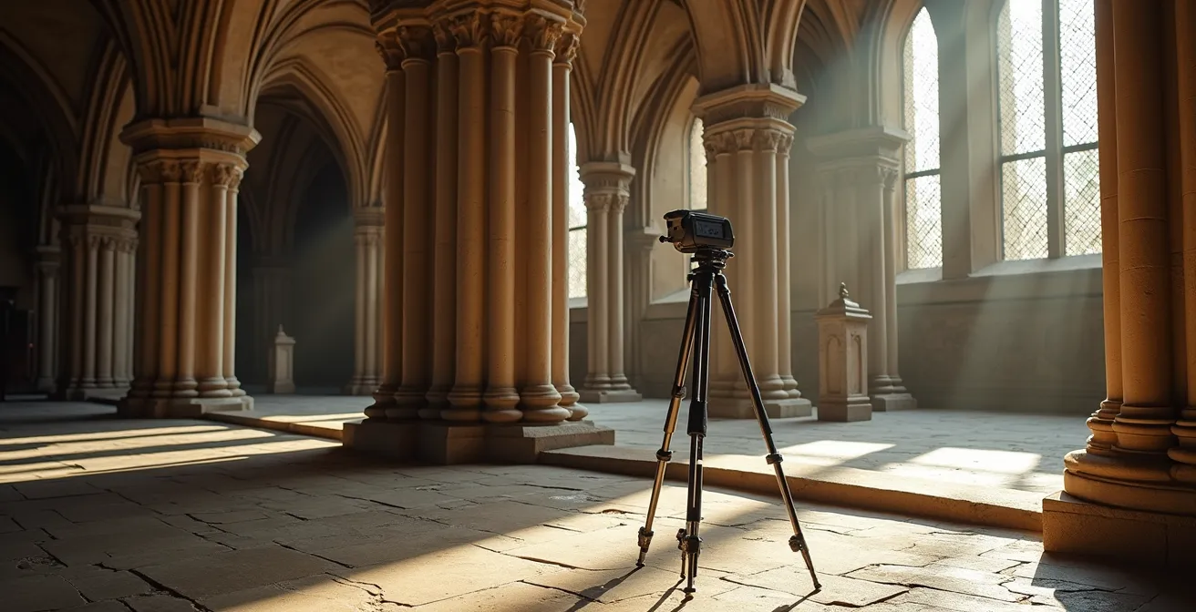
How to Plan a Scanning Mission to Avoid Lighting Changes?
For any photogrammetry project, light is both an essential ingredient and a potential source of catastrophic failure. Changes in ambient light during a scan—a passing cloud, the shifting sun over a multi-hour session—can introduce shadows and highlights that become “baked” into the model’s textures. This contaminates the scientific value of the data, as the captured color no longer represents the true surface color (or albedo) of the object, but rather a temporary lighting condition. A meticulously planned mission is the only way to mitigate this risk.
Traditional methods involve waiting for ideal, consistently overcast conditions, but this is often impractical for teams on a tight schedule. The modern solution involves a two-pronged approach: actively controlling the light at the point of capture and using software to remove it in post-processing. The most robust field technique is cross-polarization. This involves placing polarizing filters on both the camera lens and all light sources. This setup cancels out specular highlights (the “sheen” on a glossy surface), allowing the camera to capture the pure, unlit surface color, independent of the lighting angle.
On the software side, advanced algorithms can now perform “photometric correction.” By analyzing the textures of a generated 3D model, this software can identify the direction and color of the ambient light and mathematically remove it. This process creates a neutral “albedo” texture, which can then be re-lit realistically in any virtual environment. While powerful, this software-based approach works best when the initial data is as clean as possible. A combination of careful on-site planning to minimize lighting variance and post-processing to neutralize what remains is the gold standard for achieving a scientifically accurate digital replica.
The File Format Error That Could Erase Digital Art History
The ultimate goal of digital preservation is permanence. Yet, the very files we create to safeguard our heritage are themselves vulnerable to a form of decay: digital obsolescence. Choosing a proprietary file format tied to a specific scanner or software company is a ticking time bomb. When that company goes out of business or ceases to support the format, the data can become unreadable, effectively erasing the history it was meant to preserve. This is not a hypothetical risk; it is a central challenge in long-term digital archiving.
The antidote to this digital decay is a commitment to open, well-documented file formats. These formats are not owned by any single entity, and their specifications are publicly available, ensuring that future generations of software will always be able to interpret them. The Library of Congress preservation standards indicate that E57 and PLY formats are rated as ‘Future-Proof’, with a sustainability outlook of 20 years or more. These formats are designed specifically for the long-term storage of 3D data, capable of holding point cloud, mesh, and metadata information in a single, transparent structure.
The selection of a file format is a definitive statement about a project’s commitment to the future. A format tier list helps clarify the risks associated with different choices, moving from the safest, future-proof options to the extreme danger of proprietary, “black box” formats.
| Tier | Format | Characteristics | Risk Level |
|---|---|---|---|
| S (Future-Proof) | .PLY, .E57 | Open-source, often text-based, well-documented, designed for archiving. | Low |
| A (Widely Adopted) | .OBJ, .STL | Industry standards with broad software support, but can lack metadata features. | Low-Medium |
| B (Risky) | .FBX | Complex binary format with proprietary elements owned by a single company. | Medium |
| F (Danger) | Scanner-specific formats | Obsolete or purely proprietary; data is locked into a single ecosystem. | High |
Rebuild or Project: Which Preservation Method Is More Ethical?
Once a heritage site is digitized, a profound ethical question arises: what do we do with the data? Specifically, when a site has been damaged or destroyed, is it more ethical to physically rebuild it based on the scan data, or to use the data for non-invasive digital experiences like projection mapping or virtual reality? This is not a technical question, but one of cultural and ethical fidelity. A physical reconstruction, no matter how accurate, is a new object that can obscure the authentic, complex history of the original site, including its destruction.
There is no single universal answer, but a guiding principle has emerged from the highest levels of heritage management. The Venice Charter, a foundational text for conservation, has been updated with digital guidelines. The consensus is clear: the community is paramount. As stated by the UNESCO Heritage Committee in its digital guidelines, “The most ethical solution is one decided with, and for, the local and descendant communities.” This shifts the focus from a top-down, expert-led decision to a collaborative process of co-creation.
The most ethical solution is one decided with, and for, the local and descendant communities.
– UNESCO Heritage Committee, Venice Charter Digital Heritage Guidelines
This community-centric approach often leads to innovative hybrid solutions. A case study in community co-ownership reveals that combining minimal physical stabilization of a ruin with co-designed Augmented Reality (AR) or Virtual Reality (VR) experiences can be highly effective. This method respects the authenticity of the physical remains while allowing visitors and community members to experience the site’s former glory digitally. This hybrid model has been shown to increase community engagement and foster a sense of cultural ownership far more effectively than a purely physical or purely digital approach. The goal is not just to preserve a building, but to preserve its meaning.
Key Takeaways
- Technology is a Strategic Trade-off: The “best” technology (LiDAR vs. Photogrammetry) is context-dependent, balancing geometric accuracy against textural fidelity based on the site’s specific needs.
- Data Logistics are Paramount: The “Terabyte Problem” is a primary project risk. A proactive Data Management Plan (DMP) covering compression, metadata, and formats is non-negotiable.
- Ethics are Community-Centric: The most ethical use of digital data for reconstruction or projection is not a technical decision, but one made in collaboration with local and descendant communities.
Reconstructing Ancient Monuments: Boosting Tourism in Heritage Sites?
The creation of a Digital Twin—a perfect, data-rich 3D replica of a heritage site—opens up a new frontier for public engagement and economic sustainability. Beyond its archival purpose, a digital twin can be a powerful engine for tourism, education, and research, creating value that helps fund the very preservation work that makes it possible. The adoption of this model is already widespread, with a partnership involving Google Arts and Culture revealing that over 1,500 museums from more than 70 countries are implementing digital preservation strategies.
The applications are transformative. Digital twins can be used to simulate crowd flow to optimize visitor management and reduce physical wear on a site. Conservationists can test cleaning or restoration techniques on the digital model before ever touching the real object. For the public, it unlocks unprecedented access. An institution can develop a paid Augmented Reality (AR) app that, when used on-site, overlays a reconstruction of the monument’s original state onto the physical ruins. Exclusive virtual tours guided by world-renowned experts can be sold to a global audience, generating revenue without adding foot traffic.
This creates a virtuous cycle: the digital replica enhances the visitor experience and generates revenue, which in turn funds further conservation and research. It transforms the digital archive from a static, defensive measure into a dynamic, living asset. This “digital access economy” ensures that the heritage is not only preserved but also continues to educate and inspire, securing its relevance and survival for future generations. The key is to balance open access with premium, value-added experiences that create a sustainable economic model.
The next step for any institution is not simply to acquire a scanner, but to build a robust, future-proof Data Management Plan. Assess your long-term goals and begin designing that strategic framework today to ensure your digital legacy survives.